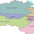
[wpgmza id=”1″]
A brief about the geography of Saddi Dilli
As we all know about the geography of Saddi Dilli it is not only the capital of India, it is situated on the banks of the river Yamuna, Dilli is located at 23.38° N and 77.13° E in the northern part of India. The state is spread over an area of 1483 square kilometre. According to the Indian geography the state is located at the centre of the Indian subcontinent and it is considered to be a part of the Aravalli Range; major part of Dilli is a plain area or soil which is very fertile. The plains can be divided into Dilli, New Dilli and Dilli Cantonment. The regions of Dilli closer to the river Yamuna are flood-prone while the ridge which is the most dominating feature in this region is surrounded by the Aravallis.
Dilli comprises of 200 villages which are heavily populated. Uttar Pradesh and Haryana are two immediate neighbors of Dilli and Punjab a distant one and all the neighbors have a strong influence on the culture and lifestyle of the people of Dilli. Yamuna is an important river in Dilli which fertilizes the alluvial soil and paves the way to extract the rain water out of Dilli.
According to the Dilli weather records, extreme temperatures dominate the capital state. Dilli experiences extreme summers and winters. In the winter season Dilli also experiences immense fog which covers the city in its blanket at times makes the visibility zero.
Vegetation of Dilli mainly comprise of medium size trees and herbs. However Dilli is known for its varied flowering plants. Weeds and grass grow on the banks of the Yamuna river.
For the ease of understanding and information I have further sub-divided into two separate sections which covers the regions in Dilli (North, East, West, South and Centrl) and NCR (National Capital Region) Separately.


Leave a Reply